Our vision is to create a tool that helps the community of Wilhelmsburg to have a better experience in finding places in the Area.
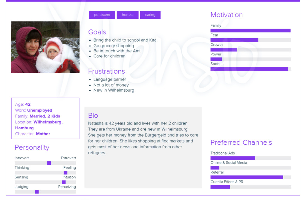
We created a persona with the name : Natasha Petruscha
To identify some of her problems we created a problem tree for her:

We are trying to find solutions to some of these problems and causes. We are focusing on the causes: no internet, no knowledge about the area, no technical education and she does not speak german or english.
So we are trying to build something that helps her with orientation, without her needing an online connection or technical education. Our goal is to offer the service in multiple languages such as Ukrainian, English, German, Arab or Turkish.
Navigation
We try to make the tool as simple as possible so everyone can use it. Therefore we only use 3 Buttons. The first Button goes forward, The second goes backwards and the third one is to confirm your decision. Much like a tab and an enter key on a computer.
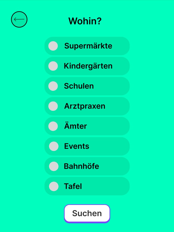
Selection Page
The first page is to choose which places the user wants to be shown. On the pictures the language is set to german.
The navigation will bring the user from top to bottom of the list and they can select all the place they want to be shown on the next page.
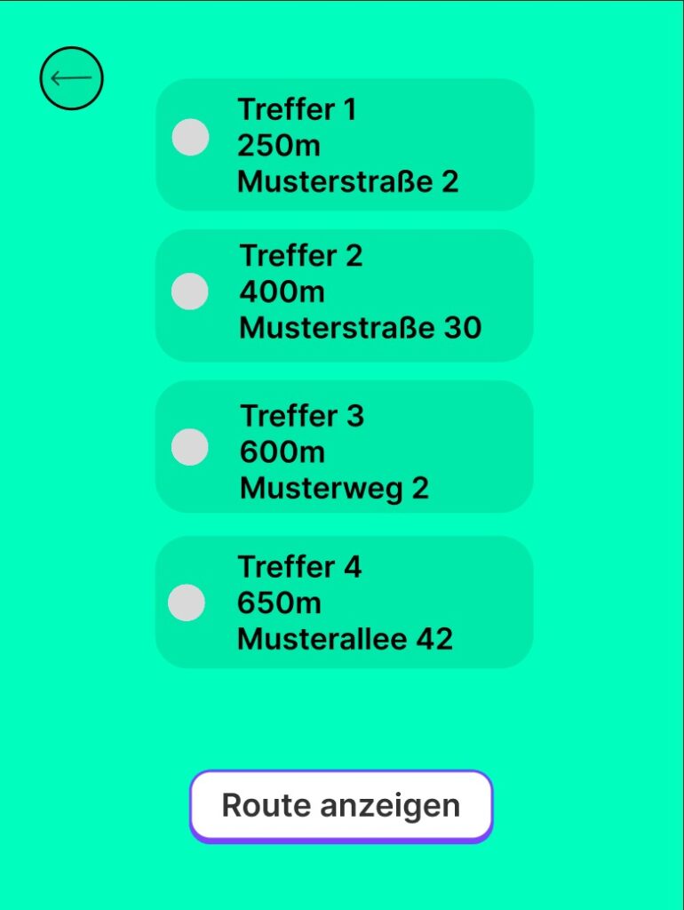
Decision Page
The next page now shows every place of the ones that were selected. The user can now choose which of them they want to navigate to. They just select the place with the two navigation buttons and confirm their decision with the third button.
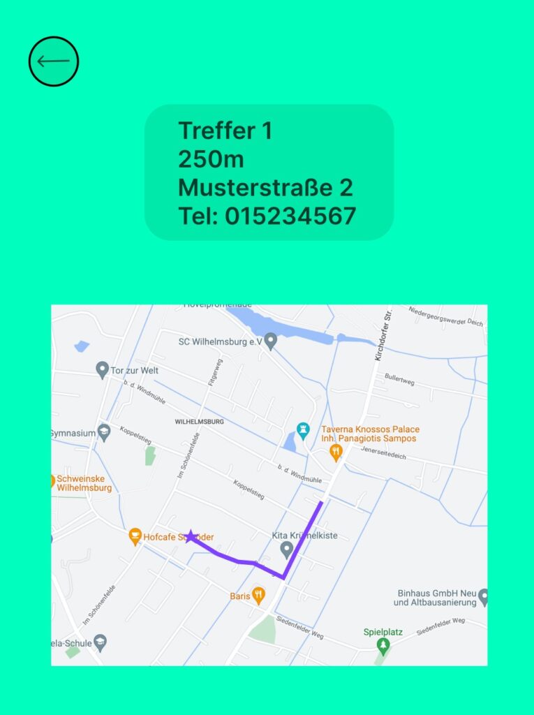
Map Page
The last page is the Map Page. On this page there is now a map. We created the map with Open Street Map. On the map the user can see the place he selected and the route to that place.
On each page, there is a little button that brings the user back to the page before in case they made a mistake.
Sources
We used OpenStreetMap for the map and built a prototype map with multiple locations. The locations are marked with pins on the map.
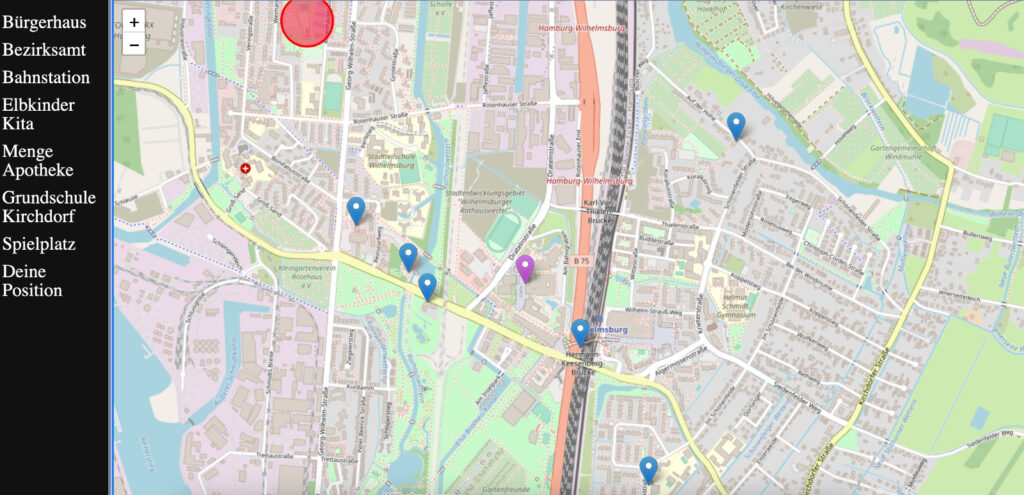
All of the locations can be implemented into this map and then labeled with the according group labels so they can easily be found over the tool.